

Jadebusen and Weser sediment management
salt marsh restoration by soil removal
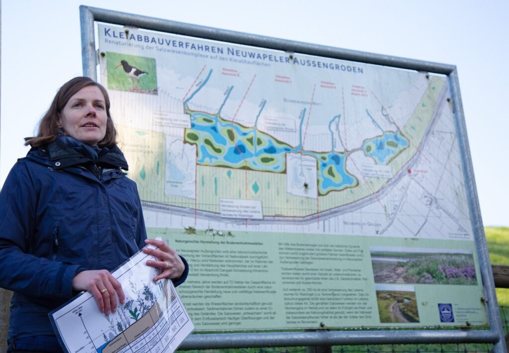
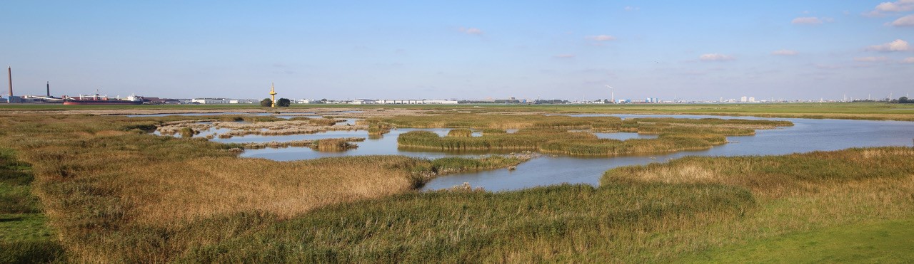
The Niedersächsiches Wattenmeer National Park wanted to improve the salt marshes. The balance in the coastal ecosystem is disturbed by the decrease of lower salt marshes. Due to the radical intervention of removing sediment, the salt marsh was lowered so that at high water salt water can wash over the salt marshes again and the salt marshes can develop again. The dike at the Neuwapeler Außengroden has been improved with the sediment from the salt marsh. The combination of measures fit in the Nature 2000 regulations.
Neuwapeler Außengroden
coordinates Google Maps: 53.3953536 , 8.2604866
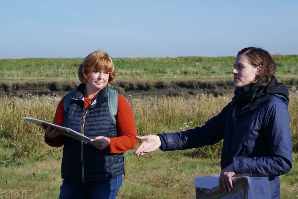
Anna Appel, Nationalparkverwaltung Niedersächsisches Wattenmeer, showed us in the introduction the concept of the restoration and the development through the years. Also part of the project are improvements for the geese in the remaining land use at this location.
The planning for a part of the dike is delayed due to the new meassurements of dike improvement (50 cm on top). Also the ‘not steady soil’ makes the delay even bigger.
This is not a single project in the National Park. There are more salt marshes that are unnaturally high. That is easier for land use, but a threat to nature. And a disbalance in the coastal ecosystem. Even if the drainage system is changed, the salt marshes are too high to be flooded by saltwater. For most of those locations, removing soil is the only option to create a lower salt marsh.
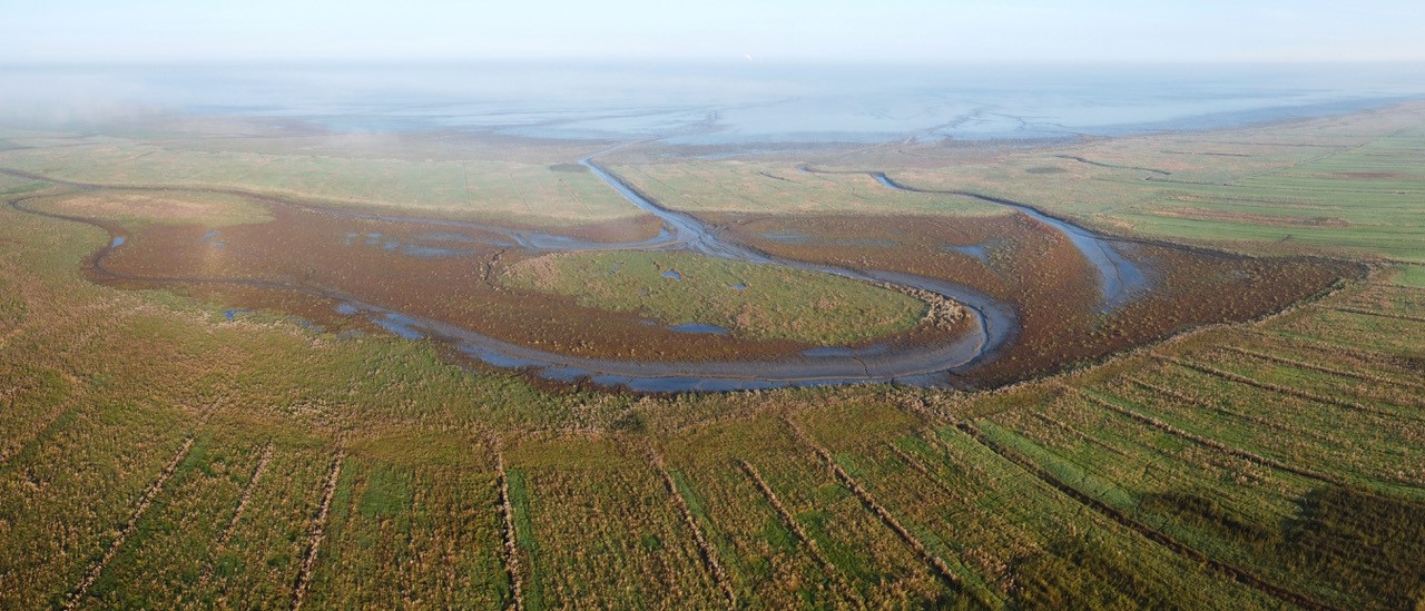
With this project, they took the opportunity to reset and give nature the opportunity to develop itself. They got rid of the artificial drainage and from now on it is a very natural development. Hopefully the tidal creeks can keep it as open as nature needs on this spot. But it is limited by the dike and the influences from the foreland.
The Neuwarder Außengroden is very open to the Jadenbusen; there is just a little barrier through the extraction site and the tidal flats itself. And with more natural development in a small scale.
reflection by peter esseling
Almost all older salt marshes are artificial and handmade. Traditionally, they are drained and used for grazing. It has fallen out of use in many locations, also because the drainage is expensive. The question is: what do we do with those 20.000 ha of artificial salt marshes? They have national values and there are opportunities to redesign them and create new salt marsh landscapes. The Neuwarder Außengroden is a very inspiring example of creating a new salt marsh landscape. It is not natural, but has a much higher degree of natural mud than traditional mainland. So you have a kind of mosaic with, in my view, a maximum of total biodiversity. In the Netherlands, people are not willing yet to give up their artificial salt marshes to create new, more natural salt marshes.
Knowing more?
- See the presentation of Anna Groeneveld at the first Sediment Solutions webinar of the 27th of November 2020, especially slide 29-40
- The page Salt marshes on the website of CWSS
Salt marshes improvement by removing summerdike
The Langwarder Groden is part of the Wadden Sea National Park. The removing of the summer dike created extensive mud flats, shallow ater areas and salt marshes, habitats for many breeding and resting birds.
Langwarder Groden
coordinates Google Maps 53.6072692 , 8.3268197
The summer dike was build in the 30th-40th. They builded the summer dike rather massive and so high that the inner dike grounds have never seen salt water. The landusers where very satisfied because they had really good green land.
The Langwarder Groden is a compensation project for the Jaden Wisardport. Anna Appel, National Parkverwaltung Niedersächsisches Wattenmeer, tells us more about the project.
It is an example of ‘managed reallignment’. There was a struggle with local citizens to remove the summerdike because they were afraid of their safety and of loss of the cultural landscape (a long history of changing the dike-line; artifacts from year 1100). A study into what happens if the summer dike is completely removed had a surprising result. The project would not be very happy about this because the main parts of the Langwarder Groden are so high that they would not flood regularly enough for a real salt marsh development. The next step was to find a solution for this. How can the compensation measures be implemented? So they removed soil to lower the service and raise the main embankment. A win-win situation. Traditional grazing is part of the solution to develop a traditional salt marsh.
.
In 2014, the salt water was let in and nature did most of the development it itself. And it still works. In 2014 it was just black with no creeks at all. It had cut a bit to instruct the water. Research into the force of the water indicated that it will not damage the main dike even in a storm. There is some damage to the summer dike. But that is part of natural development. Maybe in the future it will be necessary to change the paths. An impressive vegetation development can be seen in the salt marshes.
The prediction was that sedimentation would occur and that is being measured. There is sedimentation in all places, including the high sides that only flood with storms. The development of the trench is slowing down. From the whitening at first it went very wide (the bridge had to be secured) then it gets narrower and now it is bended.
Knowing more?
- See the presentation of Anna Groeneveld at the first Sediment Solutions webinar of the 27th of November 2020, especially slide 29-40
- On the website of Butjadingen
Tidal nature compensation area, measurements and results
In the 14th century, the Weser estuary was a delta with several separate channels and was also connected to the Jade. Butjadingen was then still an island. The tidal channels were constantly changing course. The island of Luneplate formed around 1800 in the Weser estuary as a result of mud deposits and was covered with reeds. It was separated from the mainland by the tidal river Lune, the Weser and a tributary of the Weser, the ‘Alte Weser”. It was reclaimed in 1922 and put into use for agriculture.
Since 1996, an area of 1438 ha of the Luneplate was in steps given a nature function as ecological compensation for the expansion of the Container Terminal Bremerhaven. The Luneplate nature reserve (1438 ha) has been ongoing since 1996 but was extended especially from 2003 onwards.
Luneplate
coordinates Google Maps 53.48163 , 18.52673
Since 1996, an area of 1438 ha of the Luneplate was in steps given a nature function as ecological compensation for the expansion of the Container Terminal Bremerhaven. The Luneplate nature reserve (1438 ha) has been ongoing since 1996 but was extended especially from 2003 onwards.
With the realization in 2012 of the tidal polder it was completed.
The latter is a remarkable form of managed retreat as tidal channels, banks and tidal flats have been constructed in a former agricultural area which is in open connection with the Weser estuary via an inlet with a storm surge lock.
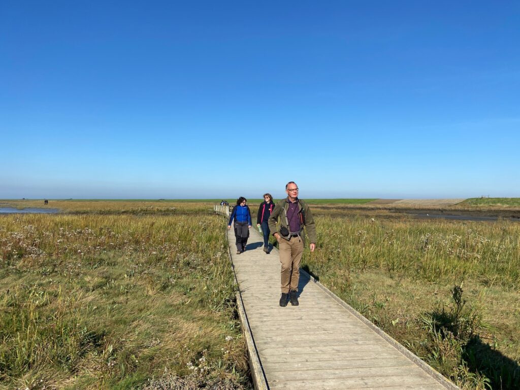
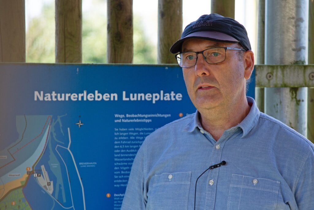
Thomas Wieland from Bremen Ports gives us an guided tour.
For the expansion of the Bremen Ports, the Luneplate have been rewetted in order to serve as an ecological compensation area.
There are three main actions in the Luneplate:
Grassland area in which the higher areas are grazed in order to create transition areas. Extensive grassland without fertilization and with high water levels. Especially as a habitat for breeding and guest birds. And the tidal polders, a flat area of around 200 hectares inland, with an open connection to the Wese.
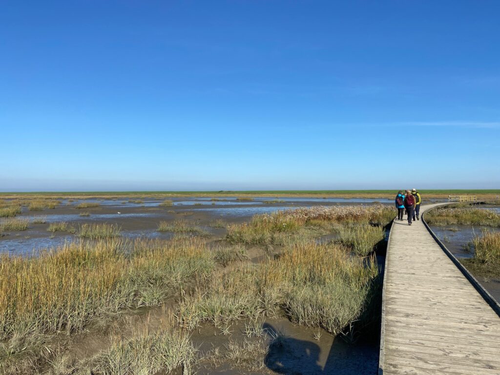
From the observation tower we can see the tidal polder. With brackish water, the mesohaline zone with a salt content of around 2 to 8 per thousand. The water of the Wese flows into and out of these tidal polder.
The adjustment in the inland still has to flow through the tidal polders (still 30km2). The barrier to sweep the storm surge is the connection to Wese. The area of the Tidepolder is silting up relatively fast. It implies that the areal extent of subtidal and perhaps intertidal areas will decrease, which will lead to a loss of natural diversity.
The higher parts are grazed with water buffalo all year round as a transition to natural parts. Outside dike is grazed with Galloways all year round. And farmers in the area use a mixture of cattle that are not that heavy and do not damage the walls.
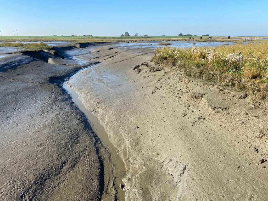
Sedimentation was measured by boat. The excavation of a tidal temple (-1.20 mtr.) has now a height of 1.80 mtr. So in nine years a landing of 3 meters. In the upper area it is 20-30 cm. What is deeply exhausted is quickly full again. And with that a lot of money for a short period. It is expected to continue, but the question is how far. The creeks are deepened at an angle. In general, the banks have become thicker and the tides have deepened. It seems it makes no sense to build deeper areas in the Wadden Sea region, because they are quickly sedimented. It should be interesting to follow the Luneplate and Kreetsand measure in combination. But the measures are not pointless. In 2012 this area was still arable and building land. The vegetation has developed rapidly and since 2014 the vegetation has been positive for the birds.
Time was to short, but it was interesting to walk to the banks of the river Weser and understand that here also nature restoration measures has been taken. And that the gully is developing naturally.
Knowing more?
- In the factsheet Luneplate
- In the Faltblatt Luneplate
- In the presentation of Thomas Wieland
Theme's
Navigate to another theme