

Ems-Dollard sediment management
landfill project
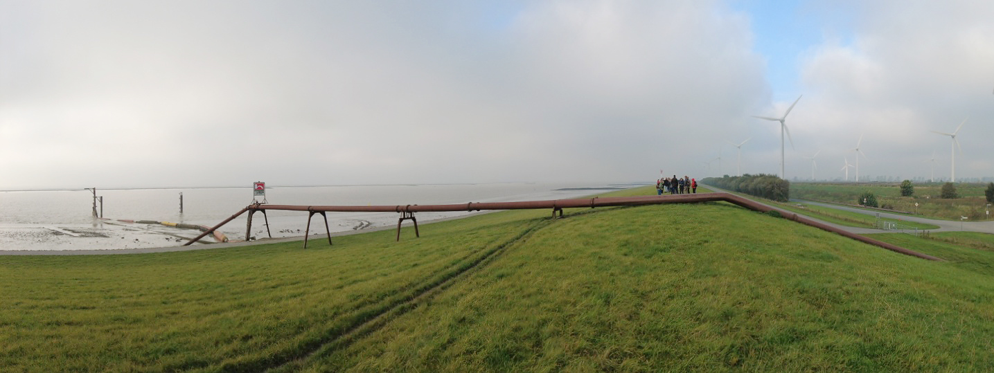
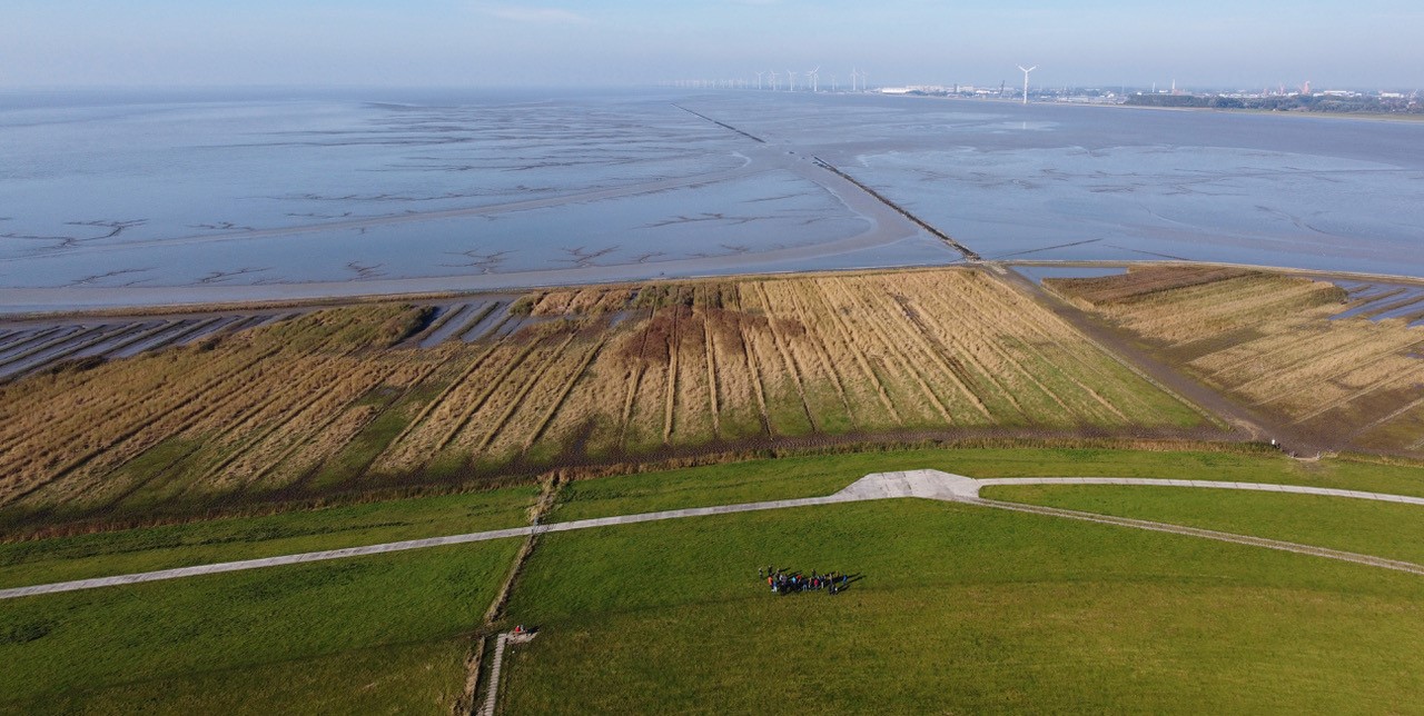
The Larrelter und Wybelsumer Polder with a total area of 6.3 km2 have been formed between 1912 and 1923. As such, it is one of the more early land reclamations with sediments dredged from the Ems estuary. The most seaward areas are now partially in use as one of Europe’s largest wind farms.
At the entrance via the Peterwoldeweg you experience the industrial and agricultural landscape and the passage to the landfill area with the difference in height compared to the foreland.
Wybelsumer Polder
coordinates Google Maps: 53.33706 , 7.13665
In a chatwalk the participants discussed several topics:
Given the estimate annual import of mud is 1,1 to 1,5 times the amount of annual deposits in the trilateral Wadden Sea, is it wise to extract mud from the Ems estuary, which is in the order of 10% of the annual import?
The Wybelsumer Polder is clearly an example where a problem (dredging sludge) leads to a solution (sediment deposition and land reclamation), which creates new problems, after which solutions are devised that are appropriate for that time (food production by farmers, housing, food production by cannery, livestock, lighthouse area, harbor (not developed), wind farm, nature reserve (developed)?), landfill (in preparation?). The whole approach led to a rather messy approach from a spatial point of view.
Land use is clearly limited in the most seaward fields of the Wybelsumer Polder. Tall windmills are combined with rugged fields that are of great value to plants and birds. However, the windmills are a threat to birds and bats. Is zoning of functions a step forward? For example bird islands with special measures to combat predation in a zone without mills and intensive use of the area with mills a way forward?
To improve the Emden Port the mooring sites Emskai and Emspier should be closed with a nourishment (2.3 ha., 337 m. extra mooring length). With Ems-side dredging activities. Is an more integrative approach possible?
Knowing more?
- Chatwalk form Wybelsumer polder
- Information about the Port of Emden can be found on this webpage
- Or in the Brochure The Seaport of Emden
Ems mud management strategie
Ems Sperrwerk
coordinates Google Maos: 53.32488 , 7.30698
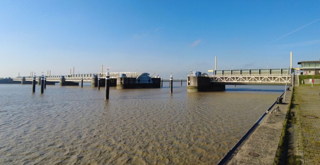
The Ems Barrage near Gandersum is one of the most modern barriers in Europe. It has been in operation since September 2002. The NLWKN (Der Niedersächsische Landesbetrieb für Wasserwirtschaft, Küsten- und Naturschutz) maintains and operates the Ems Barrage.
The 476 meter long structure fulfills two main tasks.
On one hand, it significantly improves storm surge protection on the Ems and in the Leda-Jümme area. The barrage clears storm surges that accumulate higher than 3.70 meters above sea level and thus guarantees a significantly higher safety standard than continuous adjustment along the 110-kilometer main dyke of the Lower Ems, which experience has shown would be necessary every 30 to 40 years.The barrage has long since proven itself as a coastal protection structure: From December 2005 to March 2017, the barrage was closed eleven times due to storm surge reasons.
On the other hand, the dam function of the barrage ensures the flexibility of the Ems shipping route between Papenburg and Emden and thus the preservation of the region’s economic strength. The maximum stowage destination of 2.70 meters above sea level allows ships with a draft of up to 8.5 meters to be transferred.
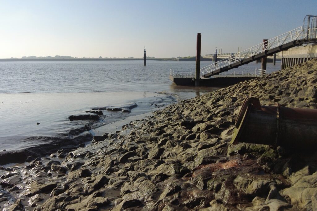
Near the Sperrwerk it is clearly visible how high the mudload of the Ems river is. The ‘Tidesteuerung’ is one of the improvement measures of the tidal Ems mud management.
Knowing more?
See the website of NLWKN
Sollard nature- and coastal safety management
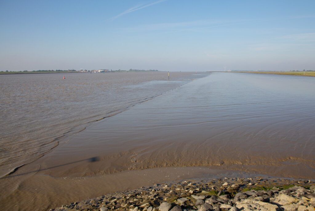
The issues of the practical management of the Dollard (mudflats, saltmarshes, dike safety and shipping lanes) is closely related to the German and Dutch improvement programs. The site visit Pogum shows the challenges of this region.
Ems and Dollard near Pogum
coordinates Google Maps: 53.317637 , 7.247923
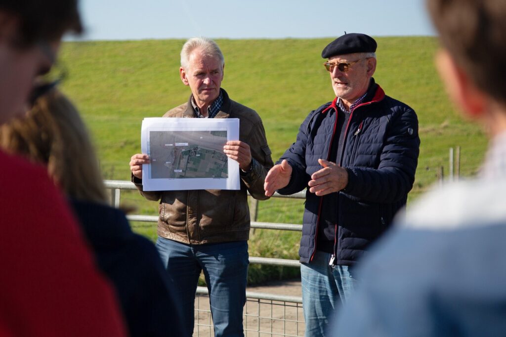
Oberdeichrichter Meint Hensmann from Rheider Deichacht tells us about tasks of the Deichacht, coastal safety issues and mud management.
The Rheider Deichacht protects around 30.00 hectare with a dike line 0f 48.8 kilometer. Money for new dyke construction comes from the state budget. Maintenance and repairs have to be paid for by the Deichacht itself. Everyone who owns a house or has a piece of land has to pay a contribution per year.
This site visit was a clear example of the complex relationship between coastal safety management, shipping accessibility measures and nature development and measures.
The Geiserdamm has been managed by the Rheiner Deichachs for around 50 years. The dam forms the border between Ems and Dollard and ensures that the mud from the Dollard does not get into the Ems so quickly. Now there are many channels and the Geiserdamm has disappeared in some places. A very large channel of about 25 meters wide and 4 to 5 meters deep flows from the Ems in Dollard. And that damages the Geiserdamm even further. This endangers water safety and therefore the Geiserdamm must be restored and the strong current must be stopped. And that restores the natural sedimentation capacity. In the coming years we will need 3.5 to 4 million m3 of clay for dyke reinforcement. To do this, sediment can be removed from the Ems and used to raise the land and avoid the danger of the dike.
Knowing more?
- See the website of Rheider Deichacht
- In the Masterplan Ems 2050
Theme's
Navigate to another theme